
MapSlicer 快速入门文档
MapSlicer 提供了一套简单的解决方案,用于对任何具备地理参考的地图图像生成切片。这些切片可以用于网络地图服务。它遵循 Open Source Geospatial Foundation (OSGeo) 的 Tile Map Service (TMS) 标准。
- 数据输入: 任何具备地理配准信息的栅格图像,例如 TIFF 、JPEG 等。可以利用 ArcGIS 、QGIS 等 GIS 系统准备数据。
- 数据输出: 一组目录包含图像切片,可导入网络服务中。部分示例位于 。
- 软件特点: MapSlicer 是一款简单易用的自由/开源软件。它提供方便的向导服务用于用户进行配置。
MapSlicer 的开发者注意到 Google Maps 、 Microsoft Bing Maps 、 Yahoo Maps 及包括 Open Street Map 在内的一系列服务使用了同样的投影系统和切片格网,切片数据可以兼容。在 Tiles à la Google Maps 页面可以看到对此的详细说明。MapSlicer 可以使用这一切片格网定义进行快速的切片服务配置。
启动 MapSlicer
- 下载 MapSlicer 或直接在 Live 系统启动。
- 选择 Tile Profile 切片格网定义 。选择 Google Maps Compatible (Spherical Mercator) 适合标准的地图服务。若需要生成 KML 文件用于 Google Earth 等软件,请选择 Google Earth (KML SuperOverlay) 。点击 Continue 继续。

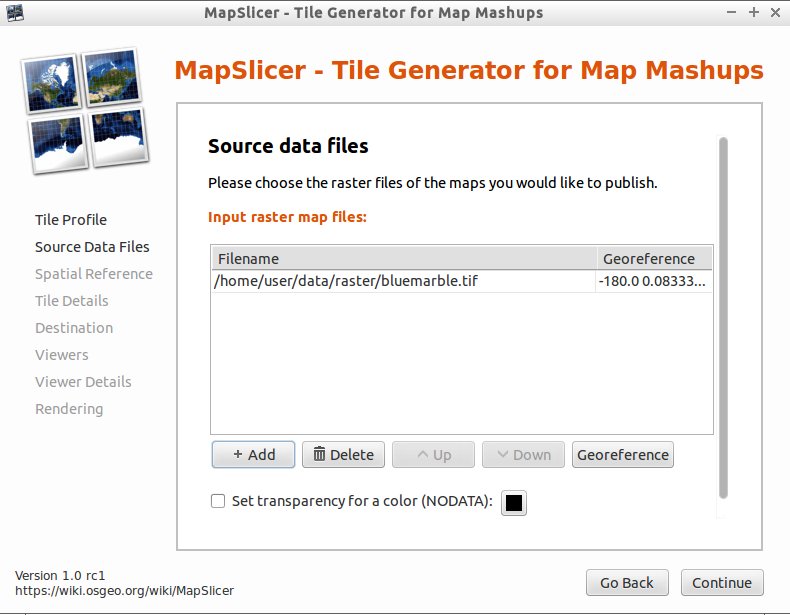
- 选择 Source Data Files 源文件 。指定需要制作切片的影象即可。 点击 Continue 继续。
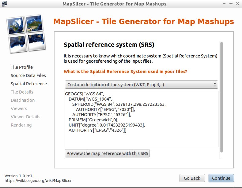
- 定义 Spatial Reference System / Coordinate System 坐标投影系统 。定义可以使用 EPSG/ESRI 投影库的 ID 号。比如 EPSG:27700 with TOWGS84 是英国范围内常用的一个投影。点击*Continue* 继续。
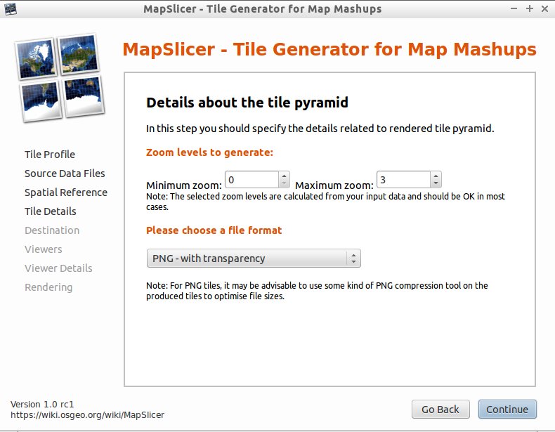
- 确定 Tile Pyramid 切片层级 的具体设置。默认的比例和文件格式一般能够满足要求。点击 Continue 继续。
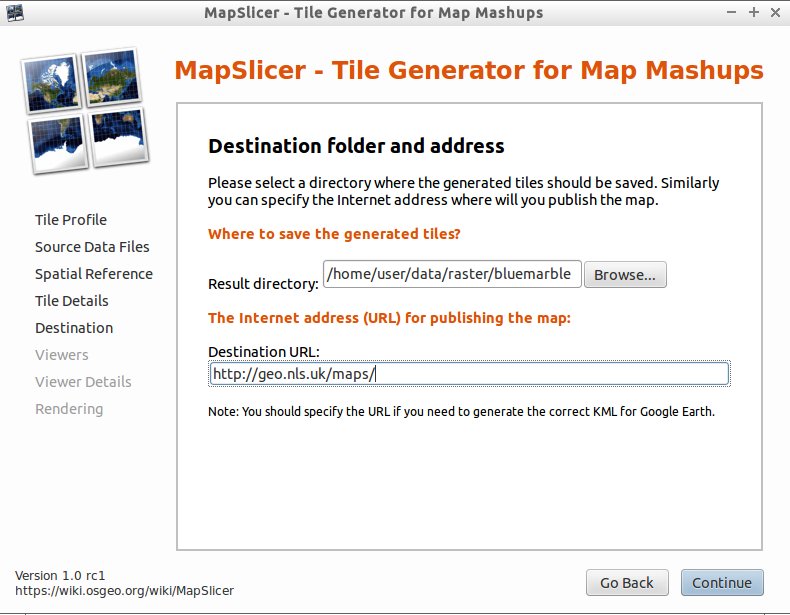
- 设定 Destination folder and Addresses / URLs 目标路径 。如果不能明确的话,可以在生成切片后将其加入 googlemaps.html 、openlayers.html 等配置。点击 Continue 继续。
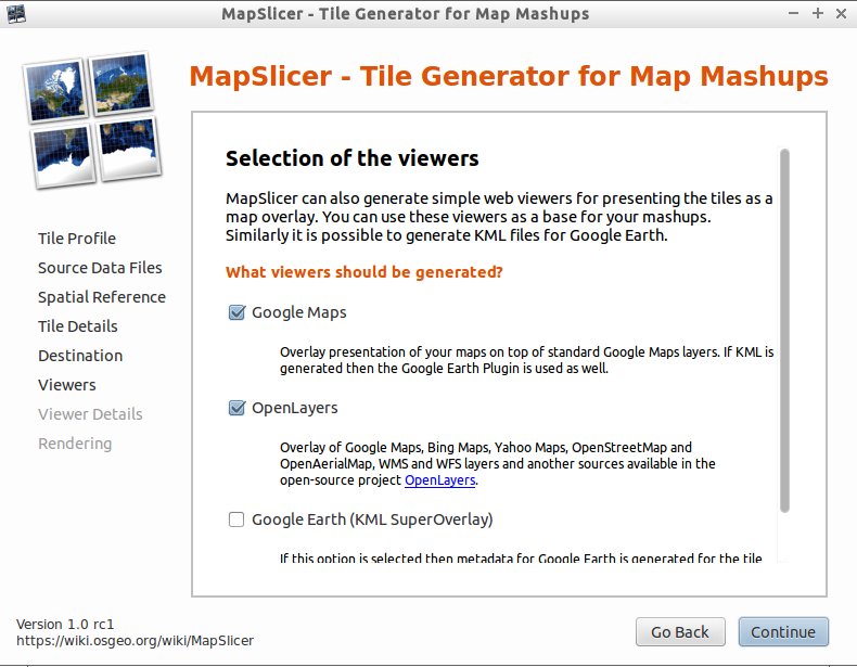
- 勾选 Viewers that should be generated 目标视图 。默认配置为 googlemaps.html 和 openlayers.html 。若需要,可以生成一个 KML 图层用于 Google Earth 。点击 Continue 继续。
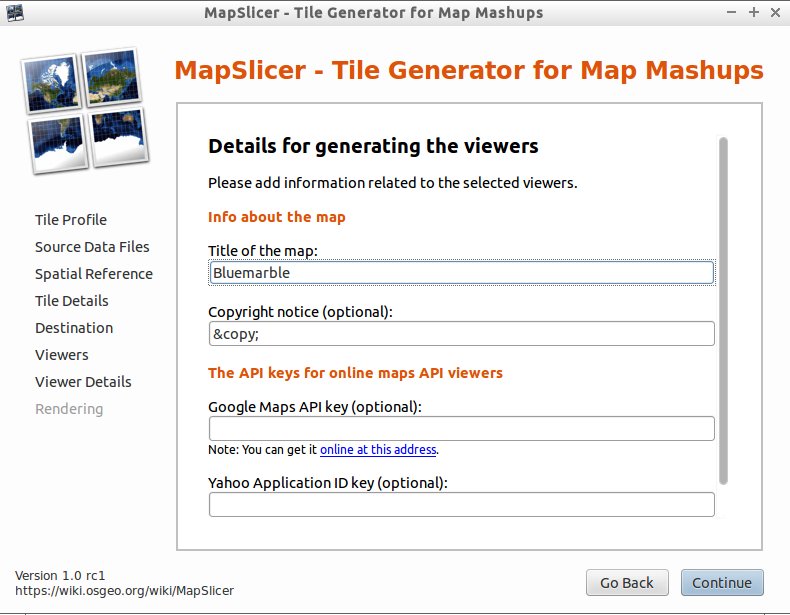
- 设置 Details for generating the Viewers 视图配置细节 。这里设计名称、版权声明、API Key 等。若不能明确,可以在生成切片后再编辑 googlemaps.html / openlayers.html 文件。点击 Continue 继续。
- 点击 Render 开始渲染切片。完成后,MapSlicer 将显示存储切片的路径。于浏览器中打开 googlemaps.html / openlayers.html 等文件即可查看生成切片叠加于底图之上的显示效果。发布切片数据时,只需将生成数据全部导入服务器中,并相应配置 googlemaps.html 、openlayers.html 等文件即可。