
欢迎使用中文文档中国镜像: http://lab.osgeo.cn/osgeo-live/
Cesium
基于浏览器的3维地图与2维地图
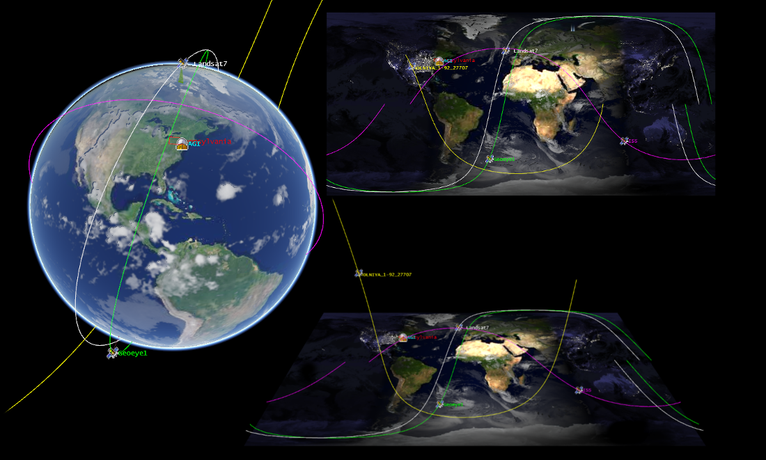
Cesium 是一个用来在Web浏览器中创建3维地球与2维地图的JavaScript库,不需要使用任何的插件。它使用WebGL进行硬件图形加速,并且跨平台,跨浏览器,适合用来进行动态数据可视化。
核心功能
- 地理空间动态可视化
- 为性能和精度进行设计
- Optimized WebGL with batching and culling efficiently uses hardware-accelerated graphics.
- Draw a wide range of geometries including polylines, polygons, billboards, labels, extrusions, and corridors.
- Control the camera and create flight paths.
- Use standard widgets to control animation time, select imagery layers, and zoom to a location.
- 一个API,三种视图:
- Cesium supports a 3D globe, 2D map, and 2.5D Columbus View with the same API.
标准实现
- WMS and WMTS
细节
授权: Apache 2.0 license
软件版本: 1.4
平台支持: Platform independent, depends only on a browser which supports WebGL
社区支持: Mailing list cesium-dev@googlegroups.com