The 52°North SOS is a web service, that allows to provide interoperable access to (spatial) observation data and associated metadata.
This Quick Start describes how to:
- Query the 52°North SOS Capabilities to determine what queries it supports.
- Query details about an Observation from the SOS.
- Use a lightweight visualisation tool delivered together with the SOS to explore the available data.
- Explore the REST API endpoint for client developers.

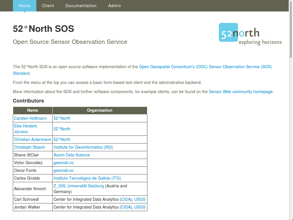
Fig. 1: 52°North SOS client - welcome page.

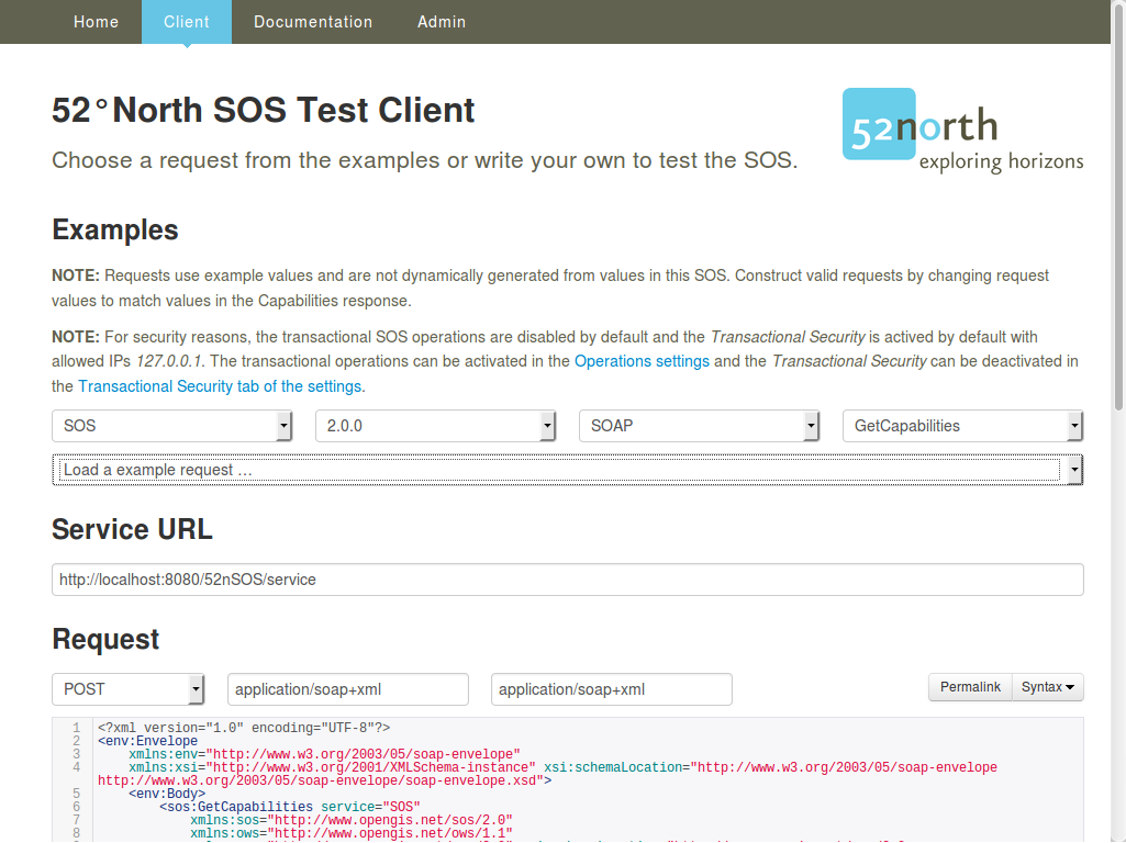
Fig. 2: 52°North SOS client - test client with GetCapabilities request.
<?xml version="1.0" encoding="UTF-8"?>
<env:Envelope
    xmlns:env="http://www.w3.org/2003/05/soap-envelope"
    xmlns:xsi="http://www.w3.org/2001/XMLSchema-instance"
    xsi:schemaLocation="http://www.w3.org/2003/05/soap-envelope http://www.w3.org/2003/05/soap-envelope/soap-envelope.xsd">
    <env:Body>
        <sos:GetObservation service="SOS" version="2.0.0"
            xmlns:sos="http://www.opengis.net/sos/2.0"
            xmlns:fes="http://www.opengis.net/fes/2.0"
            xmlns:gml="http://www.opengis.net/gml/3.2"
            xmlns:swe="http://www.opengis.net/swe/2.0"
            xmlns:xlink="http://www.w3.org/1999/xlink"
            xmlns:swes="http://www.opengis.net/swes/2.0"
            xsi:schemaLocation="http://www.opengis.net/sos/2.0 http://schemas.opengis.net/sos/2.0/sos.xsd">
            <sos:temporalFilter>
                <fes:During>
                    <fes:ValueReference>phenomenonTime</fes:ValueReference>
                    <gml:TimePeriod gml:id="tp_1">
                        <gml:beginPosition>2015-05-01T00:30:00.000+00:00</gml:beginPosition>
                        <gml:endPosition>2015-05-31T23:00:00.000+00:00</gml:endPosition>
                    </gml:TimePeriod>
                </fes:During>
            </sos:temporalFilter>
        </sos:GetObservation>
    </env:Body>
</env:Envelope>
Listing 1: Request of observations.
Try some of the other example queries from the pull down list.
Try tweaking some of these queries to get different information.
username “user” and password “user”.
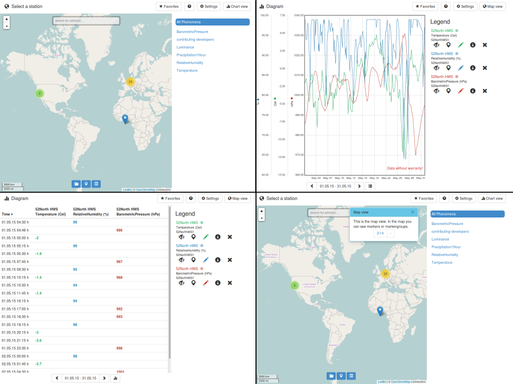
Try the View Client (see Fiq. 3).

Fig. 3: 52°North SOS client - JavaScript client with time series data.
[
    {
        id: "services",
        label: "Service Provider",
        description: "A service provider offers timeseries data."
    },
    {
        id: "stations",
        label: "Station",
        description: "A station is the place where measurement takes place."
    },
    {
        id: "timeseries",
        label: "Timeseries",
        description: "Represents a sequence of data values measured over time."
    },
    {
        id: "categories",
        label: "Category",
        description: "A category group available timeseries."
    },
    {
        id: "offerings",
        label: "Offering",
        description: "An organizing unit to filter resources."
    },
    {
        id: "features",
        label: "Feature",
        description: "An organizing unit to filter resources."
    },
    {
        id: "procedures",
        label: "Procedure",
        description: "An organizing unit to filter resources."
    },
    {
        id: "phenomena",
        label: "Phenomenon",
        description: "An organizing unit to filter resources."
    }
]
Listing 2: Output of REST API endpoint.
To learn more about 52°North SOS and/or the 52°North Sensor Web Community, potential starting points are:
The development of this version of the 52°North SOS was supported by different projects, organizations, and persons. More details can be found in the 52°North SOS client.
When the SOS is not available, please check if the tomcat servlet engine is running using the following commands:
user@osgeolive:~$ sudo service tomcat7 status
* Tomcat servlet engine is running with pid 1234          <-- Tomcat is running
[...]
* Tomcat servlet engine is not running.                   <-- Tomcat not runing, so please start:
user@osgeolive:~$ sudo service tomcat7 start
* Starting Tomcat servlet engine tomcat7           [ OK ] <-- Tomcat is running, now
Listing 3: Tomcat Status and Start (password for sudo: user).