
52°North - exploring horizons

52°North SOS

Web Service

The 52°North Sensor Observation Service (SOS) supports the interoperable provision of live and archived sensor observation data. A sensor could be a water level meter in a stream, a weather station, or an air quality monitoring station.
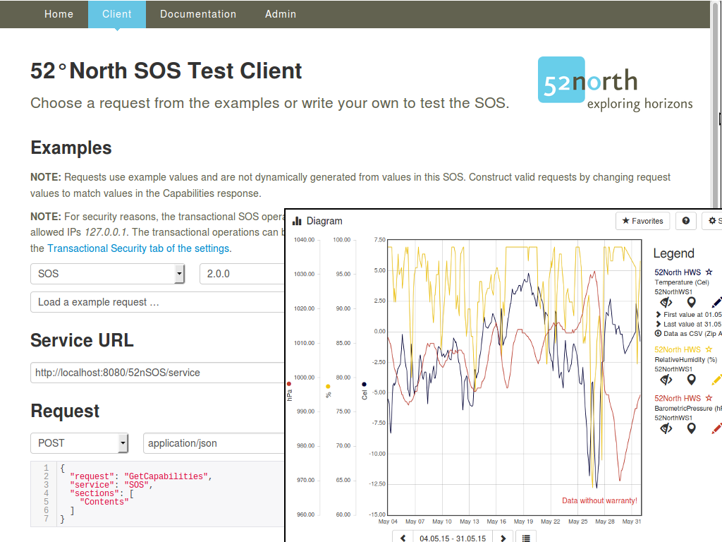
52°North SOS and JavaScript client

Features

  • Browser Client: The SOS is delivered with a browser based application. This provides means for administration and configuration of the service instance, as well as sending test requests for SOS operations; appropriate sample requests are included.
  • JavaScript Client: The SOS contains a JavaScript application for displaying time series data. With its help, time series will be visualized without any additional software.
  • Specifications: The 52°North SOS implements the current specification version 2.0.0 and the previous version 1.0.0 (here no transactional operations). Listed below are implemented operations for each standard version.
  • INSPIRE Download Service Extension: Starting with Version 4.2.0 an extension is available that allows the SOS to be used as INSPIRE download service. Background information is provided in a blog post and in the wiki .
  • Air Quality Data e-Reporting Extension: Starting with version 4.3.0 is an extension available that allows to provide for the Air Quality Data Flows E1a, E1b and E2a compliant data (the instance on OSGeo-Live is not configured accordingly). In 52°North Wiki the installation and configuration is documented.
  • RESTful API for Timeseries: Starting with Version 4.1.1. is an bundle version available, that directly brings the RESTful API . Hence, timeseries can be requested in a RESTful way in JSON encoded requests. More details incl. documentation can be found in the SOS webapp.
  • Read more: The track of the details of the implemented functionalities can be found in the 52°North Wiki.

SOS Operations

Queries:

  • GetCapabilities: for requesting a self-description of the service.
  • DescribeSensor: for requesting information about the sensor.
  • GetFeatureOfInterest / GetFeatureOfInterestTime (from 1.0): for requesting features (e.g. sensor/measurement locations).
  • GetObservationById / GetObservation: for requesting observations.
  • GetResult (from 2.0): for requesting sensor data.
  • GetResultTemplate (from 2.0): for requesting a template of the result structure that will be returned by a GetResult request.
  • GetDataAvailability (from SOS 2.0 Hydrology Profile - OGC Best Practice): for requesting the data availability for certain configurations.

Transactions:

  • InsertSensor (from 2.0): for inserting metadata of new sensors.
  • InsertObservation (from 2.0): for inserting new observations.
  • UpdateSensorDescription (from 2.0): for updating the description of a sensor.
  • DeleteSensor (from 2.0): for deleting a sensor/procedure and all related offerings and observations.
  • DeleteObservation (extension for SOS 2.0): for deleting an observation.
  • InsertResultTemplate (from 2.0): for inserting a result template.
  • InsertResult (from 2.0): for inserting results.

Within these operations the following filter operators are possible where applicable:

  • Spatial filter: BBOX, using a bounding box.
  • Temporal filter: During, with time period.
  • Temporal filter: TEquals, with time instant.

Details

Website: http://52north.org/sos

Licence: GNU General Public License (GPL) version 2

Software Version: 4.3.0

Supported Platforms: Windows, Linux, Mac

Supported DBMS: PostgreSQL (9+) + PostGIS (2+), MariaDB/MySQL (5.6+), Oracle DB (9+), SQL Server 2012

API Interfaces: Java

Commercial Support: http://52north.org/

Community Support: http://sensorweb.forum.52north.org/

Community Website: http://52north.org/communities/sensorweb/

Other 52°North projects: WPS

Copyright & Disclaimer