
deegree
Web Services
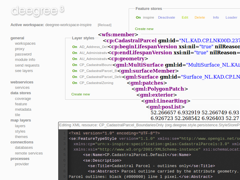
deegree provides geospatial webservices based upon Open Geospatial Consortium (OGC) and INSPIRE Network Services specifications. deegree supports:
- Web Feature Services (WFS): Serves vector data from geospatial data
- Web Map Services (WMS): Serves maps rendered from geospatial data
- Web Map Tile Services (WMTS): Serves pre-rendered map tiles
- Catalogue Services for the Web (CSW): Performs searches for geospatial datasets and services
- Web Processing Services (WPS): Executes geospatial processes

Core Features
WFS
- Implements WFS standards 1.0.0, 1.1.0 and 2.0.0
- Fully transactional (even for rich data models)
- Supports KVP, XML and SOAP requests
- GML 2/3.0/3.1/3.2 output/input
- Support for GetGmlObject requests and XLinks
- High performance and excellent scalability
- On-the-fly coordinate transformation
- Designed for rich data models from the bottom up
- Backends support flexible mapping of GML application schemas to relational models
- ISO 19107-compliant geometry model: Complex geometries (e.g. non-linear curves)
- Advanced filter expression support based on XPath 1.0
- Supports numerous backends, such as PostGIS, Oracle Spatial, MS SQL Server, Shapefiles or GML instance documents
WMS
- Implements WMS standards 1.1.1 and 1.3.0
- Extensive support for styling languages SLD/SE versions 1.0.0 and 1.1.0
- High performance and excellent scalability
- High quality rendering
- Scale dependent styling
- Support for SE removes the need for a lot of proprietary extensions
- Easy configuration of HTML and other output formats for GetFeatureInfo responses
- Uses stream-based data access, minimal memory footprint
- Nearly complete support for raster symbolizing as defined in SE (with some extensions)
- Complete support for TIME/ELEVATION and other dimensions for both feature and raster data
- Supports numerous backends, such as PostGIS, Oracle Spatial, Shapefiles or GML instance documents
- Can render rich data models directly
WMTS
- Implements Basic WMTS standard 1.0.0 (KVP)
- High performance and excellent scalability
- Supports different backends, such as GeoTIFF, remote WMS or file system tile image hierarchies
- Supports on-the-fly caching (using EHCache)
- Supports GetFeatureInfo for remote WMS backends
CSW
- Implements CSW standard 2.0.2
- Fully transactional
- Supports KVP, XML and SOAP requests
- High performance and excellent scalability
- ISO Metadata Application Profile 1.0.0
- Pluggable and modular dataaccess layer allows to add support for new APs and backends
- Modular inspector architecture allows to validate records to be inserted against various criteria
- Standard inspectors: schema validity, identifier integrity, INSPIRE requirements
- Handles all defined queryable properties (for Dublin Core as well as ISO profile)
- Complex filter expressions
WPS
- Implements WPS standard 1.0.0
- Supports KVP, XML and SOAP requests
- Pluggable process provider layer
- Easy-to-use API for implementing Java processes
- Supports all variants of input/output parameters: literal, bbox, complex (binary and xml)
- Streaming access for complex input/output parameters
- Processing of huge amounts of data with minimal memory footprint
- Supports storing of response documents/output parameters
- Supports input parameters given inline and by reference
- Supports RawDataOutput/ResponseDocument responses
- Supports asynchronous execution (with polling of process status)
Implemented Standards
- OGC Web Feature Service (WFS) 1.0.0, 1.1.0 and 2.0.0
- OGC Web Map Service (WMS) 1.1.1 and 1.3.0
- OGC Web Map Tile Service (WMTS) 1.1.0
- OGC Catalogue Service-Web (CSW) 2.0.2
- OGC Web Processing Service (WPS) 1.0.0
- OGC GML 2.12, 3.0.1, 3.1.1 and 3.2.1
Details
Website: http://www.deegree.org
Licence: LGPL
Software Version: 3.3.20
Supported Platforms: Windows, Linux
API Interfaces: Java
