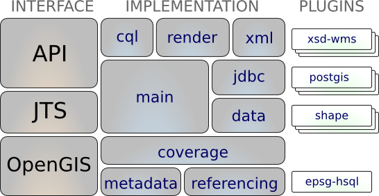

GeoTools is an open source (LGPL) Java library which provides standards compliant methods for manipulating geospatial data, and uses data structures based on Open Geospatial Consortium (OGC) specifications.

GeoTools is used by a number of projects including web services, command line tools and desktop applications. OSGeo-Live applications which include GeoTools include: 52°North SOS, 52°North WPS, AtlasStyler, Geomajas, Geopublisher, GeoServer, and User-friendly Desktop Internet GIS (uDig).
Definition of interfaces for key spatial concepts and data structures
A clean data access API supporting feature access, transaction support and locking between threads
A stateless, low memory renderer, particularly useful in server-side environments.
Powerful schema assisted parsing technology using XML Schema to bind to GML content
GeoTools Plugins: open plug-in system allowing you to teach the library additional formats
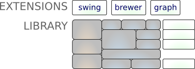
GeoTools Extensions

GeoTools Unsupported
raster formats and data access:
arcsde, arcgrid, geotiff, grassraster, gtopo30, image (JPEG, TIFF, GIF, PNG), imageio-ext-gdal, imagemoasaic, imagepyramid, JP2K, matlab.
Database “jdbc-ng” support:
db2, h2, mysql, oracle, postgis, spatialite, sqlserver.
Vector formats and data access:
app-schema, arcsde, csv, dxf, edigeo, excel, geojson, org, property, shapefile, wfs.
XML Bindings:
Java data structures and bindings provided for the following: xsd-core (xml simple types), fes, filter, gml2, gml3, kml, ows, sld, wcs, wfs, wms, wps, vpf.
Additional Geometry, Filter and Style parser/encoders available for DOM and SAX applications.
Support of numerous Open Geospatial Consortium (OGC) standards:
Website: http://geotools.org/
Licence: LGPL
Software Version: 2.7.1
Supported Platforms: Cross Platform Java
API Interfaces: Java
Support: Communication and Support