EOxServer
Web Service
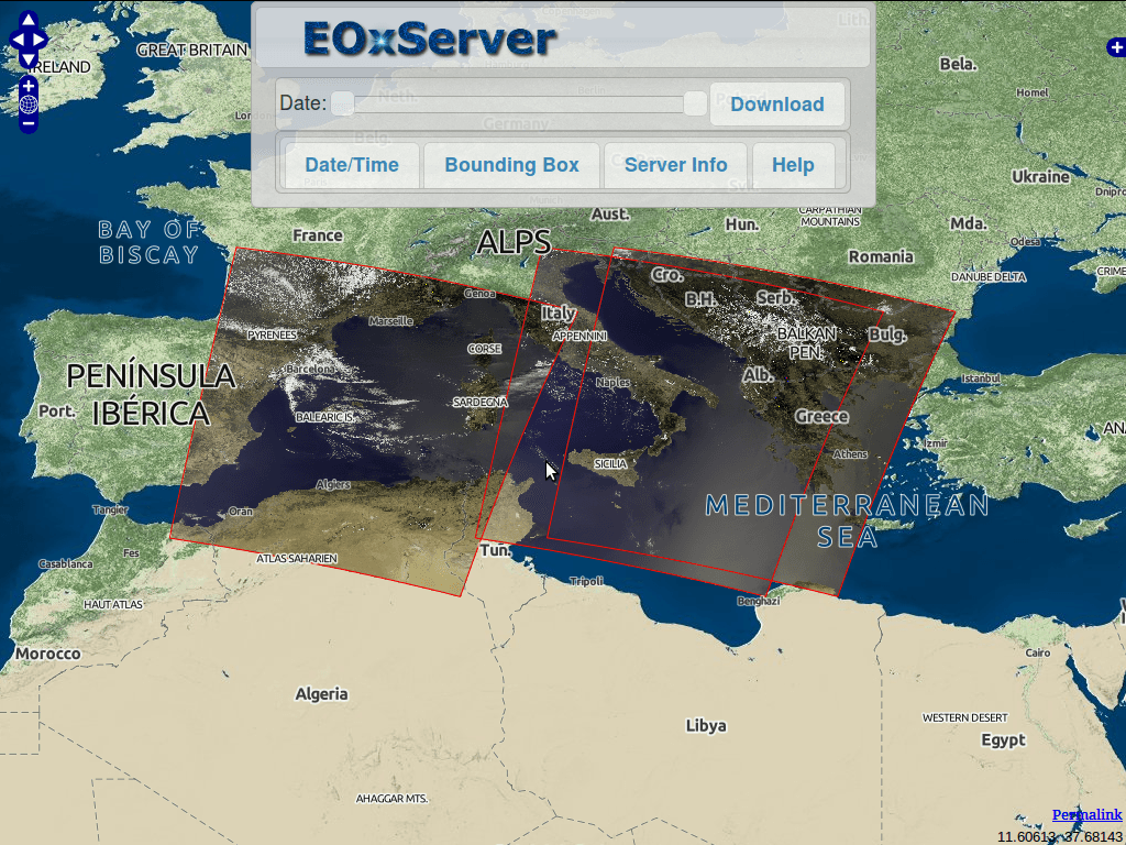
EOxServer is a server for Earth Observation (EO) data. More precisely it is a Python application and framework for presenting EO data and metadata.
EOxServer’s mission: To provide an Open Source software framework to ease the online provision of big Earth Observation data archives via Open Standard services for efficient exploitation by users.
- Open Source: MIT-style license
- software framework: Entirely based on Open Source (Python, MapServer, Django/GeoDjango, GDAL, SpatiaLite, or PostGIS, and PROJ.4)
- ease online provision: Admin GUI and command line data registration
- big Earth Observation data archives: Operators register existing raster data archives
- Open Standard services: Open in the sense of freely available; Open Geospatial Consortium (OGC); WMS, WCS, EO-WMS, EO-WCS
- efficient exploitation by users: User defined sub-setting; view and download

Core Features
The available core features are:
- Support of GML AP – Coverages for RectifiedGridCoverages
- Support of adopted WCS 2.0 specification (Core including GetCapabilities, DescribeCoverage, and GetCoverage requests, KVP-, and XML/POST protocol binding)
- Anticipated support of envisaged extensions: Coverage format, GeoTIFF encoding, predefined (or EPSG) CRSs, scaling & interpolation, and non-referenced access. By “anticipating” we mean to reflect the latest WCS.SWG discussions as well as to follow the relevant parts of the previous 1.1 and 1.0 versions of WCS.
- Support of 2-D EO Coverages derived from gmlcov:RectifiedGridCoverage
- Support of 2-D EO Coverages derived from gmlcov:ReferenceableGridCoverage
- Support of Dataset Series as a collection of EO Coverages e.g. in a time series
- Support of new DescribeEOCoverageSet operation on Dataset Series and EO Coverages
- Support of Stitched Mosaic of Rectified EO Coverages including concept of contributingFootprint
- Support of EO Metadata (retrieval and evaluation in DescribeEOCoverageSet operation)
- Protocoll bindings supported:
- KVP
- XML/POST (used together with SOAP2POST Proxy to support XML/SOAP protocol binding)
- Coverage formats supported:
- GeoTIFF
- Formats supported by the GDAL library (support needs to be verified for each required format separately)
- Support of EO-WMS for EO Coverages
Implemented Standards
- Support of numerous Open Geospatial Consortium (OGC) standards
- WCS, EO-WCS
- WMS, EO-WMS
- GML, GMLCOV, EO-O&M
Documentation
Details
Website: http://eoxserver.org/
Licence: MIT-style license
Software Version: 0.4.0
Supported Platforms: Linux, Windows, Mac
API Interfaces: Python
Support: http://eoxserver.org/doc/en/users/basics.html#where-can-i-get-support
