
AtlasStyler
Feature Style Editor
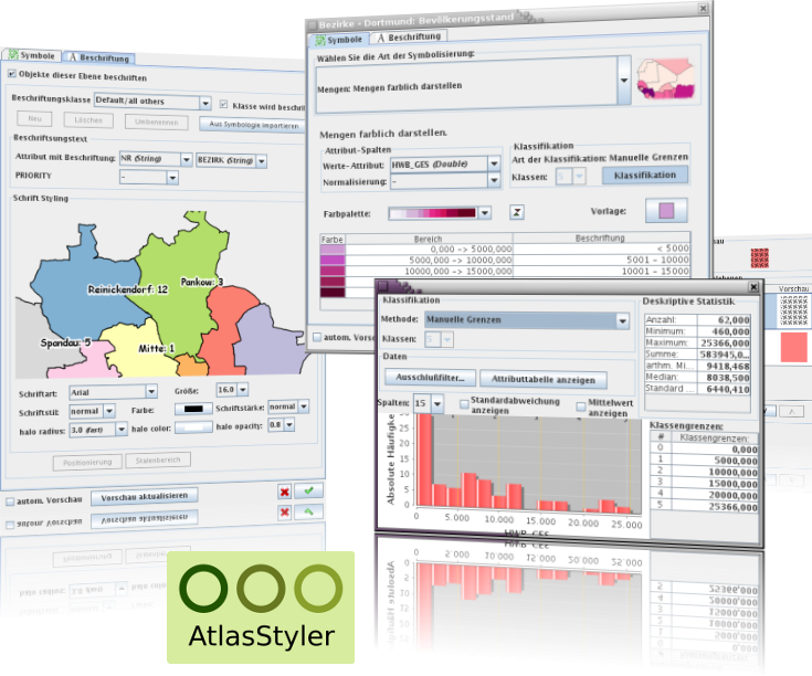
AtlasStyler is a user-friendly desktop application for styling geodata. The resulting styles can be saved as OGC standards compliant SLD/SE files.
The created SLD files are compatible with all programs which support the OGC SLD standard, including GeoServer, uDig and others. The application provides a multitude of intuitive dialogs to simplify style creation. Users can apply abstract classifications like unique values, colored quantiles or equal distance. Additionally users have integrated access to an online symbol-database. Users can create and save symbols in the SymbolEditor and reused in classifications or other projects.
Core Features
- Build styles using dialogs.
- Based on OGC SLD standard.
- Run on Windows,and Linux. (Mac support will need a little funding).
- Import from ESRI Shapefiles, OGC WFS and PostGIS databases (vector data) as well as GeoTIFF and ArcASCII files (raster data).
- Translated into German, English, Italian, Turkish, Russian and French.
Implemented Standards
- OGC Style Layer Descriptor (SLD) 1.0
- OGC Symbology Encoding (SE)
Details
Website: http://en.geopublishing.org/AtlasStyler
Software Version: 1.9
Licence: GNU Lesser General Public License (LGPL) version 3.0
Supported Platforms: Windows, Linux
API Interfaces: Java, Swing, Geotools
Support: www.wikisquare.de