

Bemerkung
Das Projekt ist nur Teil der OSGeoLive Virtuelle Maschine Disk (VMDK)
Rasdaman Quickstart
Rasdaman is a Big Data Engine for flexible ad-hoc analytics on multi-dimensional spatio-temporal sensor, image, simulation, and statistics data of unlimited size. The Web Coverage Processing Service (WCPS) query language is an Open Geospatial Consortium (OGC) standard wich allows filtering and processing of multi-dimensional raster coverages, such as sensor, simulation, image, and statistics data using web services. The WCPS queries are translated to rasdaman query language, rasql, and are executed on rasdaman. This quick start shows how to access and manipulate an example 2D coverage using WCPS language.
Inhalt
Setup
The first step before trying any of the following queries is to start rasdaman and Tomcat. Open the Databases directory on the Desktop, and then Start Rasdaman Server. Allow two to three minutes for rasdaman and especially Tomcat to fully start (once the rasdaman web client loads in the browser).
Afterwards, you can open Rasdaman-Earthlook Demo from the same directory, which will launch a local demonstrator in the browser. For a more hands-on tutorial though, continue with the next examples here.
Running WCPS queries
- Entweder:
Go to the rasdaman web client, switch to the ProcessCoverages tab, and enter your query in the query boxes and press send.
Add your query in this url: http://localhost:8080/rasdaman/ows?query=your_query and run it using a browser.
Running coverage
The example coverage which will be used subsequently is a 6 MB image as below:
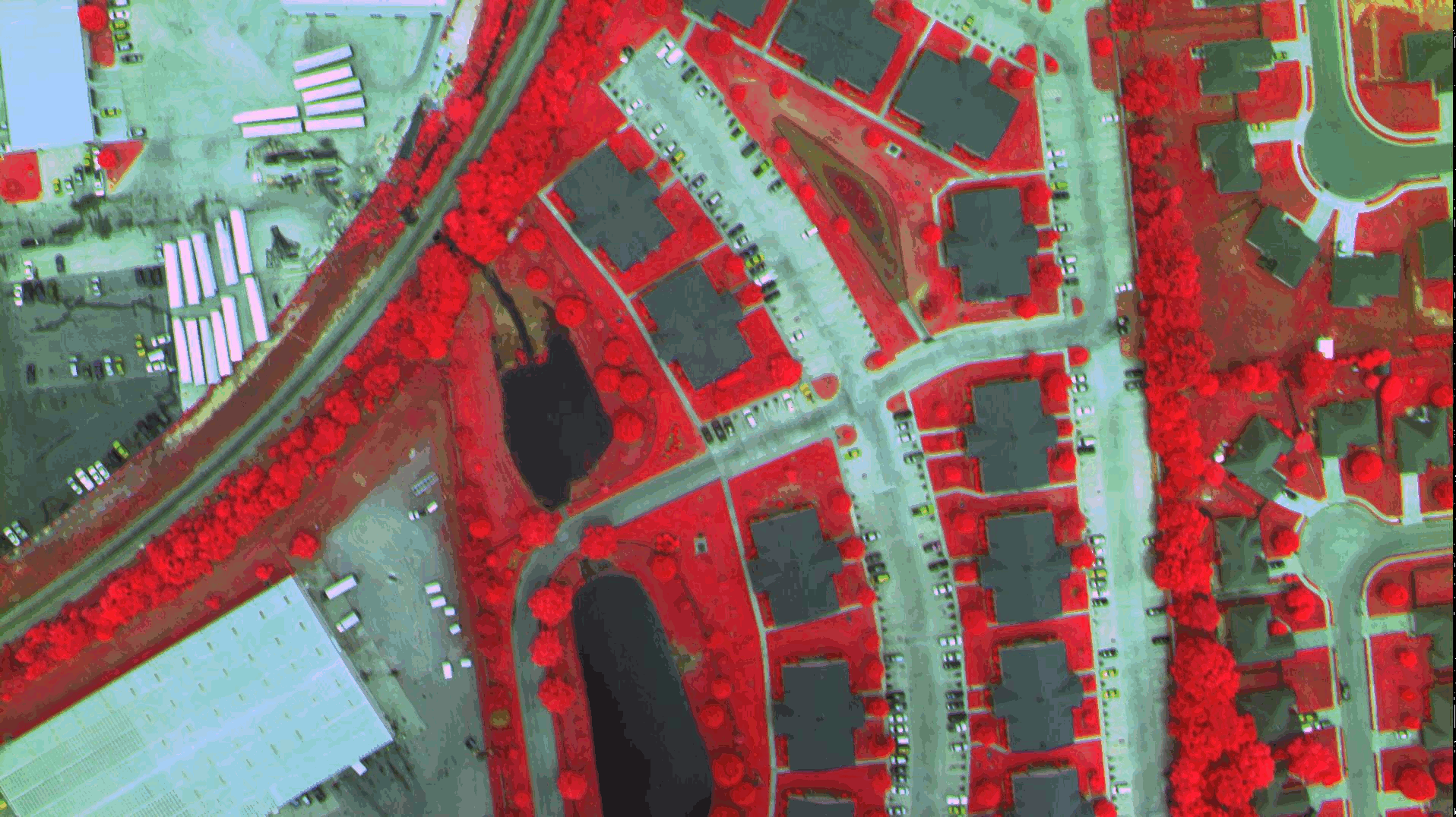
Access full coverage
The WCPS query to access the full coverage is as follows:
for c in (NIR) return encode(c, "png")
Click on coverage request to execute it in the browser.
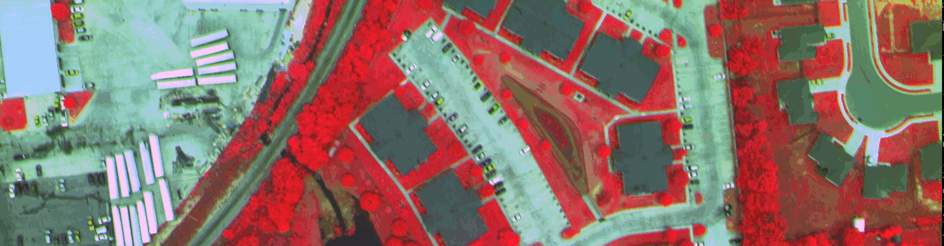
Select a subset of the coverage
The WCPS query to access a subset of the coverage is as follows:
for c in (NIR) return encode(c[i(0:500),j(0:500)], "png")
Click on the subsetting request to execute it on the browser.
The query result is an image as follows:
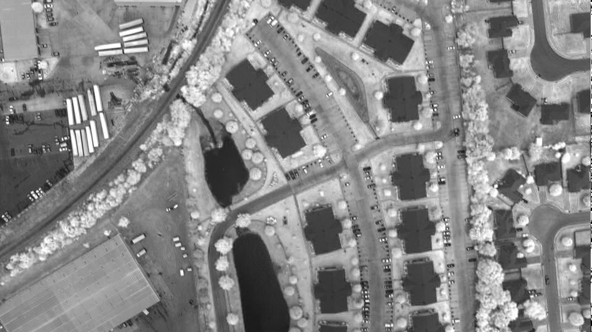
Band extraction from the coverage
The WCPS query to access the red band of the coverage is as follows:
for c in (NIR) return encode(c.red, "png")
Click on band extraction to execute it; you should see the following image in the browser as a result:
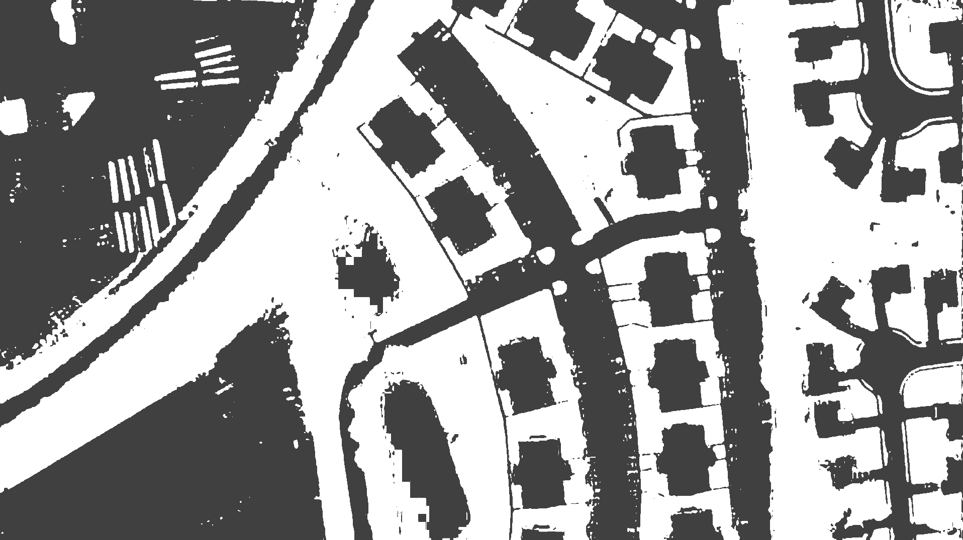
Arithmetic operation: Extracting NDVI of the coverage
The NDVI (Normalized Difference Vegetation Index) is a measure for the probability of vegetation in remote sensing, i.e., the closer to +1 a pixel is, the more likely it is plants. The WCPS query to derive NDVI from the coverage is as follows:
for c in ( NIR ) return
encode(
  (unsigned char) (
     (((float)c.0 - (float)c.1) /
      ((float)c.0 + (float)c.1)) > 0
  ) * 255
, "png" )
Was kommt als Nächstes?
The rasdaman tutorial provides a condensed introduction to the concepts behind rasdaman, rasql and the OGC web services support.
Learn more about the OGC Web Coverage Processing Service Language standard (which was heavily inspired by rasdaman); a good starting point is the documentation and tutorials page and WCPS Query SandBox.
Interested in coverage data and services in general? Visit OGC’s Coverages Domain Working Group wiki.
Explore the rasdaman documentation to learn about rasdaman administration, its query language, and data ingestion.
Go to the multi-dimensional demo to explore interactive 1-D to 4-D rasdaman demos. The small ones are part of OSGeoLive, those utilizing larger sets (beyond this drive’s capacity) forward to the OGC standards showcase site .