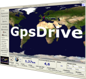
You will most likely want to install the gpsd package so that you can talk to your GPS; without that GpsDrive is just a nice map viewer.
Speech output is supported if the “espeak” software is installed. To use live-maps from the OpenStreetMap project you need to install the openstreetmap-* packages as well. Static map tiles may be downloaded from the internet without any extra installation.
If you have a GPS connected you will want to start the gpsd service. To do that run:
sudo dpkg-reconfigure gpsd
and
sudo /etc/init.d/gpsd start
BlueTooth GPS users should take special care to read up about the no-probe option.
If you don’t have a GPS connected you can turn on Explore Mode with the ‘e’ key and then use the arrow keys to move around. Right-click to set the destination target.
For help type ‘man gpsdrive‘ and ‘gpsdrive –help‘ at a Terminal prompt. This will show how to switch to Car or PDA mode which may be useful if you are working with a small screen like on a netbook.
Besides the options given in the Preferences menu and the different car/PDA/desktop modes offered from the command line, you can change the displayed dashboard meters. Just click on one of the three dashboard positions and select a new item. You can toggle on and off the dashboard and map controls with the ‘d‘ and ‘m‘ keys.
If you have a local PostGIS database running (for example the one that comes with this Live DVD) you can setup GpsDrive to render very pretty street maps on the fly from OpenStreetMap.org data using the Mapnik renderer. The PostgreSQL database it looks for on this disc is called “osm_local_smerc”. As this OpenStreetMap extract has only been loaded for the city hosting the conference, you may wish to add your own Planet.osm data with the osm2pgsql program or switch off Mapnik Mode from the Map Control window and use the built-in or downloaded static map tiles.
With the Find tool you can search out for the nearest points of interest loaded into your SQLite waypoint database. To get you started OpenStreetMap data for the city of Denver has been loaded. e.g. Find all pubs within 2 km of the conference hall.
Use the Options ‣ Maps ‣ Download tool to preview and download new map tiles. Currently the OpenStreetMap web-tiles and NASA OnEarth WMS servers are available as sources. There are a few command line programs which come with GpsDrive which will let you bulk-download a set of tiles covering your local area.
In the Preferences menu you can turn on the Friendsd service. This transmits your position to a central server and lets your friends know where you are. It comes with a program to run a private server if you don’t want the whole world seeing where you are. To enable this service go into the Preferences menu and select the Friends tab. Type in a name for yourself and click on the [Lookup] button to get the IP address of the default friendsd server. Finally tick the Enable friends service box and press [Close]. Icons showing where your friends are and where they are headed will be shown at scales less than 1:10 million. There seem to be a lot of friendly types in Europe.
GpsDrive can give you verbal warnings when you are nearing your destination, etc. To try this out you must start the eSpeak software which has been disabled by default on this Live-Disc to save memory. To switch it on you will have to edit (as root) the /etc/default/speech-dispatcher file and set RUN_SPEECHD=yes. Then launch the service with “sudo service speech-dispatcher start“. GpsDrive will automatically find it at run time if it is switched on. In the Speech tab of the Preferences menu you can enable/disable it, change the voice, and verbosity level.